European Space Solutions conference focussed on emergency response and disaster management. Accurate location data is essential for an efficient and timely response in any emergency – and positioning satellite technology is the key to providing such data.
 The session, chaired by Günter Strunz from the German Aerospace Centre (DLR), set the scene by outlining the achievements and challenges of using Earth observation and navigation techniques for emergency response.
“Timely, relevant and useable information is essential in planning and initiating an action response to an emergency,” said Delilah Al-Khudhairy of the European Commission’s Joint Research Centre (JRC). “According to the Red Crescent, information is as valuable as food, water and shelter.”
But questions remain: Are we hitting the targets? Do we have enough information products? Too many? According to Al-Khudhairy, currently the best image sensing can take from a few hours to a few days, and there is only limited satellite tasking available on a daily basis.
“Information sits at the core of the Copernicus system, and the timeliness of this information is essential,” said Al-Khudhairy. “In additon, of course, the information must suit the needs of the users.”
Future developments will include ways to accommodate social media and improve flexibility and response time.
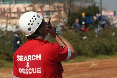
International rescue
The International Charter on Space and Major Disaster is a service that depends on multiple constellations of Earth observation satellites. The types of disasters covered are large-scale natural and man-made events. According to ESA’s Philippe Bally, the Charter only supports the immediate response phase and, for a specific event, activation of the Charter may last from one to four weeks. The service is provided at no cost to users, but the service does not provide analysis of the observation data.
An overview of the French emergency response system was provided by Samuel Gesret from the Ministry of the Interior. According to him, space technology is an important aspect of civil protection with three main functions: ensuring continuous communications, geolocation of emergency units and, increasingly, data from earth observation satellites.
Mr Gesret emphasised that timeliness and quality are the critical factors for Earth observation data. In light of this, the French National GIS platform was established for decision-making and reporting. It includes an inventory of all assets and hazards in the country, with pre-prepared analysis for fast planning and preparation of emergency responses.
Mr Gesret said that France would be linking its system into the Galileo Public Regulated Service. “We are looking forward to increasingly timely data from Copernicus as the programme moves into full operation,” he said.
According to Heinz-Dieter Meier, senior advisor on security affairs for DLR, one of the advantages of satellite-based observations is the ability to conduct very fast surveys of unapproachable regions.
Civil security was the key objective of the DLR’s Satellite Centre, which is ready for rapid response on a 24/7/365 basis. The centre is continually developing new, on-demand services. For example, the centre supported decision making during the recent flooding disasters in Germany. It also supported such major events as the European Football Championship in Poland/Ukraine and assisted with refugee support in Jordan.
A number of “next steps” are in queue, including the development of a variety of mobile applications and 3-D mission training scenarios in virtual worlds
Quake detecting
Gabriele Colosimo of the University of Rome gave an interesting presentation on the VADASE real-time GNSS seismology project – an excellent example of GNSS’ precision capabilites. This stand-alone receiver system, which started as a research programme, was a winner at the 2010 European Satellite Navigation Competition. Today it is showing real, concrete capabilities with Leica GeoSystems, with its key advantages being its low cost and fast and simple response.
Using GNSS-based seismology, it is now possible to assess earthquake displacements with near real-time accuracy using a single receiver. The technique effectively uses the GPS signal as a velocimeter, requiring four satellites in view for the algorithms to work. The VADASE proved its worth by providing invaluable data during the May 2012 Italian earthquake.
The next step is for the system to apply Galileo. It has already made some test measurements, showing encouraging results. The team is now working towards real-time analysis. A possible future application is to use the receivers to provide early, real-time tsunami warnings.
Another example of GNSS-enabled emergency response was presented by Nuno Duro of the Critical Software company. The PREMFIRE forest fire emergency service uses a tablet PC with a GNSS receiver. It also integrates electronics into the garments worn by first responders. According to Duro, the integration of technologies is an important area for adding value.
The final presentation of the day came from Vera Kraft-Holzhauer of Astrium Services, who described the IncREO project and its work to increase the resilience of earth observation data. The focus of the initiative is on asset maps, which display monetary values per unit area.
Winning ideas
In a series of presentations from the winners of ESNC 2013, a variety of innovative uses of positioning data in the emergency response sector were showcased.
AlarmApp is a smartphone-based notification system for volunteer first responders such as fire fighters. When emergency services receive a notice of a fire, the app sends alerts to volunteer fire crew. The system allows individuals to indicate via a back channel whether they are available to respond to the emergency, allowing emergency service managers to quickly know who is available and reducing response times. The system is easy to adapt to new requirements or opportunities and is already in service in Germany.
The NAVMATE wearable personal assistant allows members of, for example, a hiking group to share position data and move safely in mountainous or remote areas where mobile phone coverage is poor or non-existent. The units are low cost and enable a bridge between the group and the wider community – increasing overall safety.
Amber alerts through GNSS enables a parent to broadcast a message in the immediate vicinity of where their child was last seen and include such vital identifying information as an image and data on clothes, etc. Other users in the area receive the alert and accurate positioning of reported sightings will allow the missing child to be quickly tracked. The system could also be a useful tool in the fight against human trafficking.
Media note: This feature can be republished without charge provided the European GNSS Agency (GSA) is acknowledged as the source at the top or the bottom of the story. You must request permission before you use any of the photographs on the site. If you do republish, we would be grateful if you could link back to the GSA website (http://www.gsa.europa.eu).
More information:
European Space Solutions Conference 2013