 |
|
| |
The increasing use of digital technologies in agriculture is helping to address a host of challenges, improving farm profitability and resource efficiency whilst contributing to sustainability goals. By combining different satellite technologies (EO and GNSS), the businesses can create new value-adding applications in the field of smart farming. Following the fifth revolution in agriculture, EO data, combined with Galileo’s centimetre accuracy and boosted by EGNOS, can enable accurate and efficient variable rate applications. Leveraging the synergies created by the tandem use of EO and GNSS, a new frontier for agriculture will soon be a reality. Smart data will enable “a less is more” approach: with less fuel, water and chemicals, agriculture will evolve into a more efficient, profitable and sustainable sector. |
 |
|
| |
Accuracy is essential in aviation, thus GNSS is used extensively, with Satellite-Based Augmentation Systems (SBAS). EGNOS, the European SBAS provides access to small and medium airports through Performance Based Navigation procedures, increasing safety and enabling business growth across Europe. Currently, over 400 airports across Europe rely on EGNOS for fuel-efficient and less noisy approaches. Earth Observation data by Copernicus enables the monitoring of volcanic ash clouds, emissions, terrain (supporting optimised routing), flight procedure development and flight planning. Similar to Air Traffic Control (ATC), U-space is a drone ecosystem designed to control, manage and integrate all UAS flying within the Very Low Level (VLL) airspace. Complementing ATC, it will ensure the safety, security and efficiency of drone operations. GNSS positioning by Galileo, further enhanced by EGNOS will allow airspace regulators to create and enforce geofences around events, critical infrastructure or densely populated areas where flight is either regulated, restricted or prohibited. Earth Observation is also set to play a role in UAS (Unmanned Aircraft Systems) operations, particularly as to supporting safe route planning. For instance, maps that integrate Earth Observation data can provide operators with insights on population density, allowing them to plan routes that avoid crowded areas. |
 |
|
| |
Biodiversity of ecosystems are representing natural assets essential for the development of our environment. Long used to monitor land and marine environments, Earth Observation offers numerous products and services for protecting – even restoring – ecosystems and preventing further biodiversity loss. These include forecasting the impact climate change will have on essential ecosystems, providing environmental monitoring, analysing the effectiveness of EU policies and managing resources. GNSS, on the other hand, supports biodiversity and ecosystems by providing data collected by tracking animals displaced by habitat loss. National authorities also rely on GNSS when conducting forest inventories, a process that involves quantifying and describing forest resources and health. |
 |
|
| |
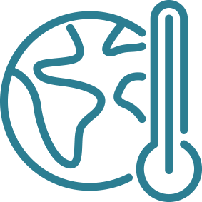
Implementing fuel-efficient flight paths, monitoring CO2 emissions and providing long-term forecasting are just a few examples of how the EU Space Programme helps mitigate the risks of climate change. Specifically, researchers use Copernicus’ historic datasets to monitor changes in sea levels, permafrost and the icecaps and to build better forecasting models. Climate scientists also use GNSS to measure vegetation and soil moisture, which further support climate modelling. |
 |
|
| |
GNSS-enabled Consumer Solutions comprise a multitude of applications, tailor-made to satisfy different usage conditions and needs (e.g. lifestyle, tourism, health, etc.) These applications are supported by several categories of connected devices such as smartphones and tablets, but also specific equipment such as personal tracking devices, wearables, digital cameras and portable computers. Nowadays, with a combination of technologies such as GNSS, 5G, Wi-Fi and Internet of Things (IoT), any physical device can become a connected device, enabling new applications to facilitate the end user’s wellness and lifestyle. Technological advances and substantial reductions in the costs associated with operation and supporting infrastructure (e.g. data storage) for satellites, have led to a dramatic rise in the availability of satellite imagery for civilian use in recent years. This significant amount of information on Earth’s condition, often available on (at least) a daily basis, has enabled application developers to create service and information layers that enable dozens of apps for various purposes. From air quality forecast thanks to Copernicus services to cardio routes. |
 |
|
| |
When disaster strikes, communication, information and location are key factors to saving lives. The EU Space Programme provides all three. Copernicus and Galileo allow emergency and humanitarian aid actors to prevent and respond to crises by enabling informed decision making, coordinated operations and a better use of time and resources, while GOVSATCOM provides secure, cost-efficient communication capabilities to security and safety-critical missions. |
 |
|
| |
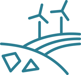
GNSS and Earth Observation provide valuable data to the energy and raw materials sectors – data that helps guide everything from site selection to planning and monitoring construction projects. When a site or mine becomes operational, Copernicus data is used to monitor its operational life and environmental impact. Galileo’s timing data can synchronise energy networks and smart grids, while mining operations depend on its precise positioning information to safely move machinery and heavy equipment. |
 |
|
| |
Satellite data, particularly Earth Observation data, have long played a pivotal role in environmental monitoring and resource management. But today it is also used for a range of new applications, including environmental auditing and ecosystem accounting. And, with an increased focus on sustainable development, the private sector is now leveraging EO data to assess the environmental impact of its activities and to support regulatory compliance. |
 |
|
| |
Copernicus and Galileo play a key role in supporting a sustainable fishing and aquafarming sector. For example, by tracking fish stocks and fishing vessels, they help authorities prevent illegal, unreported and unregulated fishing. By providing information and data on environmental conditions and long-term weather forecasts, EO-based applications help select ideal locations to establish aquafarms. Once an aquafarm is operational, much of the work is done by fully automated vessels that rely on the accurate positioning and navigation provided by Galileo. |
 |
|
| |
Earth Observation and GNSS are fast becoming key enablers in the forestry sector. For example, EO data is used to remotely monitor forest inventories and detect illegal logging and deforestation. GNSS, when coupled with EO, opens the door to a range of precision forestry operations, including guiding machinery and applying fertilisers and irrigation. |
 |
|
| |
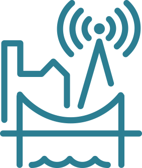
EU Space supports the entire infrastructure life cycle – from initial site selection to the monitoring of construction and post-construction operations. Galileo and Copernicus help construction companies, infrastructure managers, public authorities and utility operators increase the safety of their operations and enhance productivity all while improving infrastructure resilience and safeguarding the environment. |
 |
|
| |
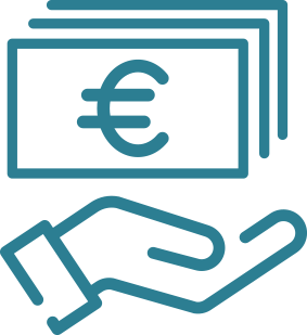
Finance and insurance have a rising interest for spatial technologies. GNSS and Earth Observation play a key – and increasing role – in the (re)insurance and financial sectors. For instance, timing and positioning information provided by Galileo is used in claims assessments and to time-stamp financial transactions. Copernicus data, on the other hand, is used for everything from conducting risk assessments to computing indices, assessing damage and managing claims. |
 |
|
| |
Thanks to the EU Space Programme, authorities and maritime operators can rely on three different types of satellite data that allow them to see, navigate and communicate. Copernicus provides the near real-time data needed to evaluate the state of the sea, currents and temperature. Moreover, the Copernicus Maritime Surveillance Service allows for vessel monitoring even at night thanks its capability to produce Synthetic Aperture Radar images. Galileo’s accurate signals make navigation easier and more reliable; and satcom data ensures uninterrupted communications – even in the open seas. |
 |
|
| |
Urbanisation, population growth, new technologies and an increasing demand for sustainability are all factors contributing to a new era of mobility. The European Union has positioned rail as the backbone for transporting people and goods. The EU Space Programme and its components support rail operations and increase passenger safety. Not only does EGNSS provide precise positioning and localisation, when augmented by EGNOS and possibly fused with other sensors, it has the potential to replace the expensive physical balises used to monitor train speed and streamline rail operations. EGNSS’ potential becomes even greater when its positioning is complemented by Earth Observation data. For example, railway operators can use Earth Observation data to monitor and prevent vegetation encroachment, landsides, and other risks that could endanger the safe operation of trains. |
 |
|
| |
EU Space plays a big role in the road transportation and automotive sectors – including improving safety and sustainability. Galileo enables Europe’s eCall emergency service and is used to track the transport of dangerous goods, implement road user charging schemes and reduce traffic congestion. Copernicus is used to monitor emissions and, when combined with Galileo’s accurate positioning, such critical infrastructure as tunnels, motorways and bridges. EU Space technology also enables a range of smart mobility solutions. |
 |
|
| |
EO and GNSS are invaluable tools for the transition to smart, connected and climate neutral cities. City authorities, urban planners, real estate agencies, cultural heritage managers and surveyors all use solutions powered by EO and GNSS to perform a wide range of applications. The Copernicus Sentinel constellation for instance, delivers high-quality free satellite imagery that allows for the estimation of characteristics related to urban structure. Moreover, the Copernicus Atmosphere Monitoring Service generates essential information on air quality in urban environments, measuring particles that might affect the heath of citizens and monitoring greenhouse gas emissions. This is also critical when monitoring cultural heritage sites, whereby the impact of air quality and potential ground subsidence may become catastrophic. EGNSS-based solutions are also used, in conjunction with EO, to accurately survey and map urban areas and to build advanced 3D models of the built environment. |
 |
|
| |
Although originally designed to serve terrestrial users, today, GNSS also plays an important role in many space applications. Whether used for telecommunications, Earth Observation, research or navigation, Earth-orbiting satellites rely on the real-time positioning and timing provided by GNSS. Thanks to GNSS, these missions can reduce costs, improve navigation performance, and ensure the provision of trustworthy data and services. |