The processing of the Galileo signal in a multi-constellation environment is providing important benefits and opportunities for precision farming, enhancing the performance of livestock and increasing the achieved accuracy in difficult mountain environments. A Spanish company, Ixoriguè, has integrated Galileo in its positioning solution as part of a combined product for livestock management.
A solution for extensive livestock in high mountains
Ixoriguè is the result of an innovative project, jointly funded by the Government of Aragon (Spain) and European Funds (EAFRD), aiming to improve the processes within extensive mountain stockbreeding, which are usually difficult to put into practice due to the challenging geographical locations of the majority of the areas. These processes include the monitoring and follow-up on livestock, in particular on certain parameters related to the health of the animal, its habits, movements, etc.
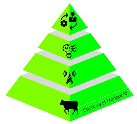
The solution developed by Ixoriguè constitutes an excellent example of how the integration of satellite positioning, sensors, Earth observation, and data management and analysis, can respond to different needs within the livestock management.
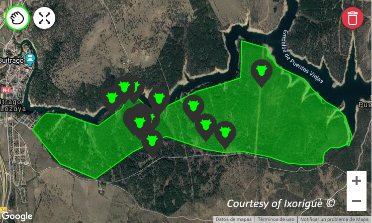
This solution is based on hardware and software technologies to digitalize the management of livestock farming, increasing resource efficiency and optimizing productivity. A dedicated collar tracks the amount of movement and activity of the animals, and checks their geolocation periodically. The data obtained during the sampling period is transferred to the Cloud platform using low consumption communication technologies. This information allows to determine possible problems in the animals and to see certain reproductive parameters. In the first stage, data are introduced by the farmer in the application and organized per different cattle. The accurate localization of the animals combined with activity measurements are periodically sent to the processing platform. After processing, it is possible to define certain behaviour patterns, and to trigger alerts according to planned events. The graphic representation of the data and the generation of dedicated reports help the farmers in their daily planning. Galileo plays a key role in all this process, tracking the movement and the behaviour of the animals, moving in difficult environments throughout the day.
Ixoriguè Solution Processing Chain
Availability and Accuracy improvements thanks to Galileo
As Ixoriguè team explains, better geo-localization performance is achieved thanks to the introduction of Galileo. “Under this multi- constellation scenario, accuracy remains below 5m in the majority of the cases. Availability is also improved, mainly in harsh environments such as high mountains and tree canopies”, states Adrià Martínez, CTO at Ixoriguè Technologies.
With the combination of navigation and Copernicus Sentinel 1 and Sentinel 2 data, Ixoriguè solution is able to predict grazing areas and available pasture, helping with the recognition of the vegetative state of the pasture and providing data-driven recommendations to optimize the management of the cattle.
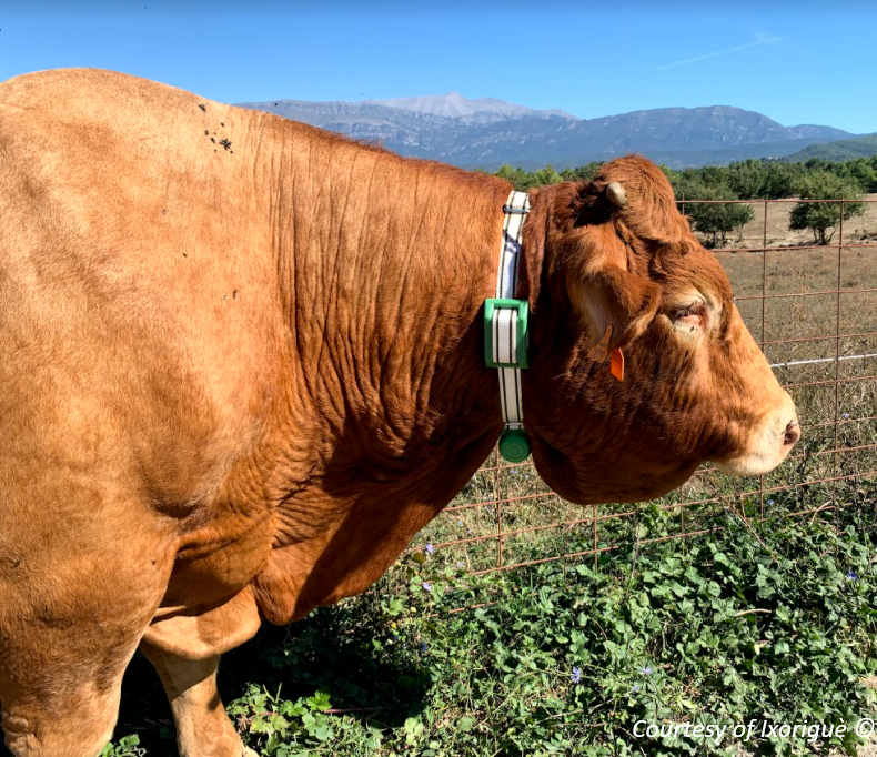
Each animal is provided with a Galileo-enabled chipset and other sensors for health monitoring
Ixoriguè is now focusing on the development of a new solution for Virtual Fencing, where satellite positioning techniques will be combined with other devices to slow down animals in the proximity of a virtual fence, avoid the loss of animals, and optimize the grazing areas.
With more and more farmers, entrepreneurs and innovators turning to EUSpace to devise solutions for challenges on Earth, Ixoriguè is an inspiring example of how the next-generation space applications are combining both European GNSS positioning with Galileo and Earth Observation from Copernicus services for more competitive and sustainable solutions.
Thanks to Galileo, an accurate positioning of the cattle is achieved
We would like to thank the team of Ixoriguè Technologies team for their availability and cooperation in preparing this story.
Media note: This feature can be republished without charge provided the European GNSS Agency (GSA) is acknowledged as the source at the top or the bottom of the story. You must request permission before you use any of the photographs on the site. If you republish, we would be grateful if you could link back to the GSA website (http://www.gsa.europa.eu).