In the framework of GNSS cooperation between the European Union and Japan, a test was recently conducted of a GNSS-based global Emergency Warning Service using Japan’s Quasi-Zenith Satellite System (QZSS), which delivered impressive results.
The European Union is looking into the potential 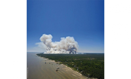 for deploying a new, global, emergency warning service (EWS) based on the EU Space Programme Galileo, as part of the EU Horizon 2020-funded GRALLE project (Galileo-based Reliable Automatic and Low Latent Emergency warning service).
Tested with QZSS
As the service should be based on a common alert protocol, one of the elements of the project is the development of a common alert messaging standard with QZSS, Japan’s satellite-based augmentation system (SBAS). This was the reason behind the recent test of the system with QZSS in a suburb of Melbourne, Australia.
During the test, an alert message was prepared warning of a fire in the Melbourne suburb and uploaded in the ground segment of the QZSS system. The message was then uplinked to the QZSS satellites and broadcast to smartphones in the alert zone.
A prototype receiver using a smartphone in the alert zone received messages with instructions to follow based on where in the zone they were located. Some users were advised to remain inside and wait for emergency services to arrive, while others were instructed to leave the area and proceed to a pre-determined meeting point.
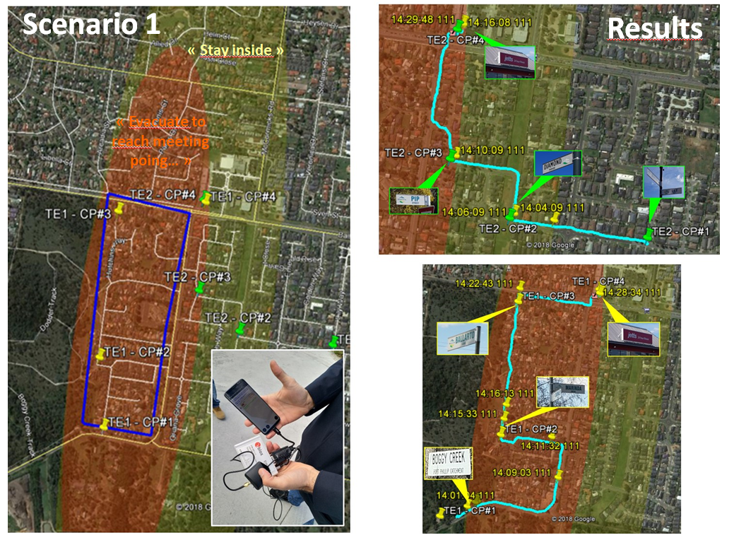
Smartphone users received messages with instructions to follow based on where in the alert zone they were located
The test was performed with only the L1S signal from QZSS, meaning that no other communication infrastructure (e.g. mobile towers) was used. The local Australian civil protection authorities who took part in the test were very impressed with the results.
Many benefits
European Commission Project Officer Frédéric Domps highlighted the many benefits of the project. “A GNSS-based Emergency Warning System will bring significant advantages for countries that do not currently have such a system, and even for countries that already have a land-based system,” he said, adding that a Galileo-based Emergency Warning Service would be global in its scope, resilient to ground damage and deployable in response to all types of hazards, from earthquakes to forest fires and terrorist attacks.
“The next steps should involve the conducting of further testing and refinement of the service definition,” Domps said.
Timeline
It is planned that the concept will be refined in 2019 with the objective of reaching a decision for implementation with the relevant EU organisations. Service deployment should then proceed with the objective of having a fully operational service in the 2023 timeframe.
Media note: This feature can be republished without charge provided the European GNSS Agency (GSA) is acknowledged as the source at the top or the bottom of the story. You must request permission before you use any of the photographs on the site. If you republish, we would be grateful if you could link back to the GSA website (http://www.gsa.europa.eu).