Access to the Galileo signal in a multi-constellation environment is providing benefits and opportunities for businesses, thanks to the enhanced performance and increased accuracy on offer. Here we look at the experience of one GIS technology company in northern Europe that has been leveraging Galileo to increase the positioning accuracy of its solutions.
Use of a Galileo-enabled receiver significantly increases the number of satellites in view. This, in turn, considerably reduces the time needed to obtain a position with centimetre-level accuracy, compared to the performance from single-constellation receivers. Businesses have been eager to incorporate these performance gains into their solutions and pass the benefits on to their customers.
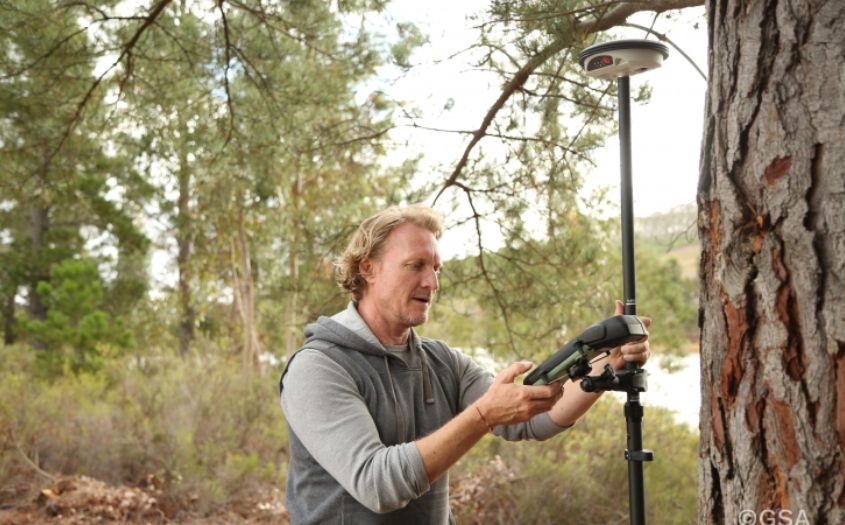
Swedish geographical information technology company SCIOR Geomanagement AB makes use of various technologies, such as drone aerial photography, terrestrial laser scanning, GNSS, or various combinations of these, in its equipment.
As a producer of measurement technology, SCIOR is well aware of the benefits of RTK processing techniques and incorporates this approach to obtain faster and more accurate positions. However, the company also uses Galileo-enabled receivers to increase the positioning accuracy of its solutions even further.
Centimetre-level accuracy
According to the company’s findings, which it presented at the last Intergeo conference in Stuttgart, it has been achieving significantly enhanced performance and other benefits in its day to day activities from the use of Galileo-enabled equipment.
“Our experience with Galileo has shown an improvement in the density of the constellation of visible satellites, and thus an improvement in the time needed to obtain centimetre-level accuracy. From my personal point of view, I would recommend using this constellation in combination with the other existing ones, since it provides you with a better and quicker performance,” said Javier Corral, an engineer at SCIOR Geomanagement AB.
The most significant performance improvements are observed at high latitudes and within forest environments. Even taking into account that better results can be obtained in open spaces, using multi-constellation GNSS with Galileo in the woods is sometimes the only way to obtain a satisfactory performance if there is no reference station close enough.
Good indicator
SCIOR’s testimonial about the benefits of using Galileo in high latitudes and harsh environments serves as a good indicator for other companies working in similar environments. Moreover, performance will be even better in coming years as the number of Galileo satellites increases to reach Full Operation Capability (FOC), allowing users to obtain their desired position accuracy and availability in a shorter period of time.
In the meantime, to continue harnessing the benefits of Galileo and multi-constellation users can register at the European GNSS Service Centre (GSC) or contact the GSC Helpdesk at: www.gsc-europa.eu/helpdesk .