The European Commission has released version 2.0 of the EGNOS Open Service Definition Document (SDD). The revised document reflects recent improvements in EGNOS geographic coverage and other enhancements.
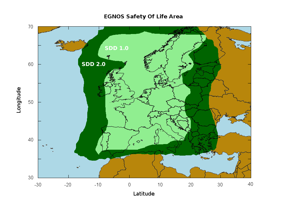
The new version 2.0 of the European Commission’s EGNOS SDD (Open Service Definition Document) reflects recent improvements implemented for the EGNOS service. The document shows significant improvements in the geographic coverage of the EGNOS Open Service as can be seen from the map below.
The update is of particular interest to receiver manufacturers, GNSS applications developers and users.
What is EGNOS?
 EGNOS is the European Geostationary Navigation Overlay Service and is the European Satellite-Based Augmentation System (SBAS) that complements the GPS system by improving the accuracy and providing integrity for the signal.
Both European businesses and citizens are benefiting from EGNOS. It can support new applications in many different sectors such as agriculture (for high-precision spraying of fertilisers) or transport (enabling automatic road-tolling or pay-per-use insurance schemes). EGNOS can also support much more precise personal navigation services, both for general and specific uses.
Media note: This feature can be republished without charge provided the European GNSS Agency (GSA) is acknowledged as the source at the top or the bottom of the story. You must request permission before you use any of the photographs on the site. If you republish, we would be grateful if you could link back to the GSA website.