The European Space Solutions conference covered aspects of transport on land (chaired by the European GNSS Agency (GSA)) and water, with a focus on how space solutions are making a real impact on the mobility of goods and people both regionally and world-wide.
The European Space Solutions conference focused on two major areas for satellite navigation applications in transport: road and maritime.
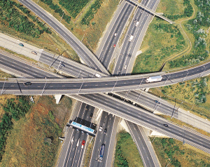
An application gold mine
According to the latest GSA Market report, the road sector represented 60% of future potential revenue. “This is a gold mine!,” exclaimed Gian Gherardo Calini of the European GNSS Agency (GSA). “More people need to be joining the ‘dig’ as the gold is in the many applications and services that we can develop using GNSS signals from EGNOS and Galileo.”
One part of this gold mine may be in advanced driver assistance. According to BMW’s Ulrich Fastenrath, in-car navigation services are the traffic management systems of the future: “Drivers trust them more than gantry systems for information.”
In urban areas, a large proportion of road space is occupied by static traffic. With urban population density on the rise, combined with a trend for vehicle ownership, the clear mobility challenge of the future is how to keep people moving. According to Fastenrath, this will require seamless, multimodal transport systems and information technology (including positioning).
“The increasing proportion of electric vehicles on the road will also require an easy-to-access power charging infrastructure for which positioning will be essential,” he said.
Another technology breakthrough aimed at enabling better mobility is highly automated driving, which Fastenrath believes is close to becoming a reality: “To achieve this requires highly accurate positioning on motorways including position and direction relative to the lane – which can be accomplished with satellite positioning.”
Better positioning can also save lives. For example, the eCall system, the pan-European emergency call service for vehicles that provides seamless support to emergency services across the continent, is dependent on accurate GNSS signals. Upon activation, the European Commission mandated service sends a small packet of data, including position, to emergency services. This significantly reduces the time to intervention and saves a large number of lives. “Knowing the position is a key factor to reaching an incident quickly,” said the Istituto Superiore Mario Boella’s, Fabrizio Dominici.
Another area of influence is automatic tolling systems. For example, Slovakia’s GNSS-enabled Skytoll road user charging system is a flexible solution for extremely efficient toll collection. According to a case study, Skytoll was fast to implement and its costs were much lower than alternative wide scale tolling technologies. The system can also prove valuable in vehicle localisation, traffic management and smart city applications.
Air quality issues
 In the context of road traffic, air quality concerns are due to emissions of small particulates (PMs) and NOx that triggers numerous non-compliance incidents in various urban areas. According to Laurence Rouil of INERIS, the integration of Earth observation and GNSS can enable air quality monitoring and forecasting.
As an example, the PREV’AIR project was showcased. This project adds value via Copernicus data and allows for the implementation of consistent European Commission local modelling and forecasting chains. This in turn enables better public information and control strategies for pollution.
Roland Leigh of the University of Leicester took this concept one step further. By using GNSS he was able to realise intelligent routing, which reduced overall journey times and pollution. The ultimate goal is to use air quality forecasting to modify traffic light signal control. The concept is scheduled for large-scale testing in 2015.
Setting sail with GNSS
With 90% of trade happening by sea, the sea and waterways are by far the most widely used mode of transporting goods worldwide. Thus, efficiency, safety and optimisation of marine transport are key issues.
Satellite technology has fundamentally changed maritime navigation, with the sector being an early adopter of the technology and always quick to embrace new navigational developments. For this reason, maritime and waterborne transport remains a major and growing market for satellite navigation solutions.
One example of this emerging space-enabled technology is e-Navigation, the International Maritime Organisation’s (IMO) concept for the future of navigation. E-Navigation involves the integration of systems and the provision of relevant information to ensure safety of life, protection of the environment and energy efficiency. Within the EU, there is also the e-Maritime initiative, which is a wider concept aimed at promoting the effective use of resources and integration across transport modes.
Resilient Positioning, Navigation & Timing (PNT) is an essential component of these initiatives, and GNSS is the primary means – in fact often the sole means - of achieving it. There is a clear need for greater resilience of GNSS and new systems such as Galileo and EGNOS plays an important part in terms of integrity and authentication.
“Maritime trade can be made safer, greener and more efficient, and space solutions have an important role to play here,” said Dr Nick Ward of the General Lighthouse Authorities, UK and Ireland. “However, in order to succeed, these solutions need to be planned, coordinated and integrated.”
The European Commission’s view was presented by Massimiliano Esposito from the Maritime Safety Unit in DG MOVE. According to him, around 17 000 individual ships are tracked on a daily basis in EU waters, making European waters the most well-monitored maritime region.
“Integrated maritime data is a key element for future safety, and programmes like CleanSeaNet, which provides a near real-time oil spillage and anti-pollution detection and response service, are prime examples of how this can be done.”
He noted that the EU will begin the formal application for Galileo’s inclusion into the World-wide Radio Navigation System in 2014. He anticipates that Galileo will meet the requirements for a wide range of maritime navigation applications.
EGNOS video
The new EGNOS maritime themed video premiered during the event. The GSA-produced promotion highlights what EGNOS is doing for craft of all sizes and what Galileo promises for the future. EGNOS maritime applications are already helping to improve navigation, operations, traffic management, seaport operations, inland waterways, offshore exploration and exploitation, and fisheries.
Following the video, Stig Erik Christiansen, GNSS Product Manager at Kongsberg Seatex AS, discussed the benefits of EGNOS to the maritime sector in more detail. “[EGNOS] is an enabler for operations and a driver for performance, and offers a huge range of applications,” he said.
According to Christiansen, e-Navigation is all about the harmonisation of marine information from berth to berth: “EGNOS is bringing the maritime domain into the digital age,” he said. “In the future, GNSS receivers will be one of many sensors for navigation and an integral part of any ship’s bridge.”
Collaborative weather forecasting
At the close of the session, Fabio Riva of the COSMEMOS gave an intriguing presentation on collaborative weather forecasting in the maritime environment. The idea is to transmit meteorological data with accurate positioning information from ships on the move, effectively using the craft as a distributed sensor network. With the better knowledge of real conditions that this system will provide, improvements to safety and fuel economy can be realised.
Two sensors based on GNSS signals have already been developed: one to measure wave height and another to give a vertical profile of meteorological parameters. The next step is to transmit this information at low cost.
Media note: This feature can be republished without charge provided the European GNSS Agency (GSA) is acknowledged as the source at the top or the bottom of the story. You must request permission before you use any of the photographs on the site. If you do republish, we would be grateful if you could link back to the GSA website (http://www.gsa.europa.eu).
More information:
Videos: