Precision agriculture is an area where satellite-enabled services have made a big impact. But sometimes the weather gets in the way or farmers need very high resolution data. Now EGNOS is being used to help develop a flexible ‘camera in the sky’ service that can provide the essential data that farms need, when they need it.
 Satellite technology and augmentation systems, such as the European Geostationary Navigation Overlay Service (EGNOS), have made a major contribution to the widespread adoption of precision techniques in agriculture. Satellite tracking and monitoring of ploughing and harvesting, and the distribution of fertilizer, herbicide or irrigation water are some of the many tasks that can be facilitated using satellite-based services to optimise the use of resources and gain the maximum crop yield.
But even with high technology it is possible for the weather to intervene and this is where FieldCopter, a European Commission funded FP7 project managed by the European GNSS Agency (GSA), is making its mark.
The FieldCopter project is developing an integrated Unmanned Aerial System (UAS) sensing service for precision agriculture. “As a basis we are adapting an existing UAS platform called SARAH using EGNOS to autonomously fly accurate pre-programmed paths covering the agricultural land of a customer,” explains Paul van der Voet of project coordinators TerraSphere based in the Netherlands.
“Although there are various optical satellite-based precision agricultural services already operating throughout Europe, none are able to guarantee imagery at all the essential times during the growing season due to cloud coverage” continues Paul. “In addition, the existing services offer maps that are not at the high resolution – sometimes less than 0.5 metres – that are needed for some specific crop monitoring purposes such as in vineyards or orchards.”
On-demand service
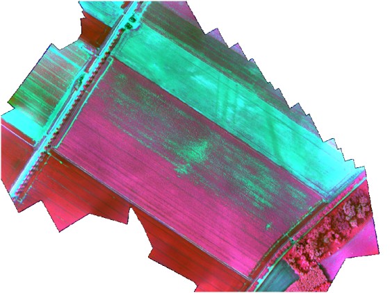
 The FieldCopter service will offer on-demand, very high resolution maps of agricultural fields to allow improved crop management. The maps will be derived from imagery captured with the EGNOS-enhanced SARAH platform and converted to crop stress indices and crop management task maps. Maps are provided to the client within 48 hours of the survey to allow timely adaptation of the application of, for example, crop protection chemicals, fertilizers or irrigation water.
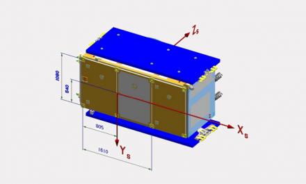
“For FieldCopter the SARAH platform is modified by integrating an EGNOS receiving capability and installing a 6-band multispectral camera capable of recording in the near-infrared and red-edge domains of the optical spectrum, as well as a thermal infrared camera,” says Paul.
The SARAH platform developed by Flying-Cam is routinely used for action filming and is highly stable with an electrical vibration minimization system to provide high quality imagery. The extreme stability of individual images and the positional accuracy of EGNOS mean that it is much easier and faster to automatically process the images to produce composite mosaics and therefore the map data that farmers require within the necessary timeframe.
“FieldCopter will allow farmers to gain economic and ecological benefits through optimal use of resources like water, nutrients and crop protection agents,” states Paul. “And it proves the potential of a European-wide precision navigation system. EGNOS is a key enabler to develop this service.”
Harmonisation required
One non-technical issue that requires further work within and outside the project is the harmonisation of the regulatory approach to UAS operations in Europe. “There are very wide differences in regulation of below 150kg UAS operations in the different EU Member States at the moment,” explains Tamme van der Wal of FieldCopter consortium member, AeroVision. “A harmonised approach would be most helpful so that EU-wide services for precision agriculture can be planned and developed with more certainty.”
The project will formulate recommendations on how UAS services should comply with current and upcoming regulatory and legal frameworks.
Full field testing is already underway with flights performed in the Netherlands to test the system in assessing the variable rate of application of potato haulm killing agent – an essential element of the harvest process - where minimising use is a key environmental issue.
During the summer of 2013, a second demonstration trial will take place in the winegrowing area of Catalonia to monitor water stress. This is also the venue for the Ninth European Conference on Precision Agriculture that is taking place in Lleida, close to Barcelona, in early July.
‘We will be holding a stakeholder meeting, workshop and demonstration activities at the conference,” says Paul. “It will be a great opportunity to ‘show and tell’ what FieldCopter can provide to the sector and get some feed back from potential service users to make sure the product is the best it can be.”
The FieldCopter initiative is actively promoting the commercial uptake of the use of EGNOS, and subsequently Galileo, by the European agricultural community, while at the same time contributing significantly to more efficient and effective use of crop protection agents, industrial fertilizers, and irrigation water.
Media note: This feature can be republished without charge provided the European GNSS Agency (GSA) is acknowledged as the source at the top or the bottom of the story. You must request permission before you use any of the photographs on the site. If you republish, we would be grateful if you could link back to the GSA website.
More information: